

Location- Between Telluride and Ouray Colorado, can be run either direction
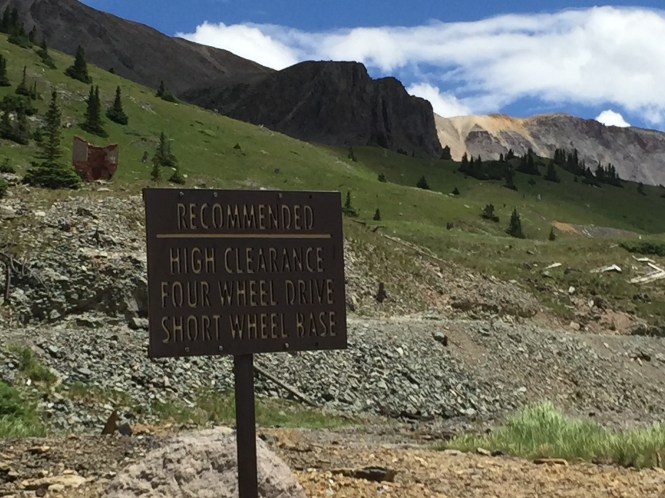
Easy to Moderate, due to shelf road drop offs.
This is one of my favorite trails of all time, the views are the best. This is one of the closest alpine trails to our house, we can see Mt Sneffels from our living room window. I like to run this trail from Telluride to Ouray, so we can hit the hot springs with the kids in Ouray, it is also nice only having to drive home 40 minutes to Montrose, versus the hour and a half at the end of the day.
To get there from Ouray, drive through town heading to Red Mountain Pass, after getting to the end of town, keep an eye on the right side for box canyon falls, you will see a large parking lot on the left, where people park trailers for OHV’s. Turn right and drive past the box canyon turnoff and continue up the gravel road, it will eventually split near the camp bird mine, Imogene is on the left, and Yankee Boy basin is the on the right.
From Telluride, it is harder to find, I drive into down, and right when you hit downtown, take a left into the residential neighborhoods, drive up a few blocks and look for the signs that point to Imogene Pass and Tomboy Mine. The trail starts in a congested neighborhood, and drives by a few houses built into the mountain before the trail begins.

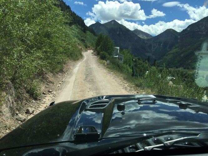
Here I am driving into Telluride, I take a left before the big brown building, and drive up a couple blocks until I see the signs, pointing the direction of Imogene.
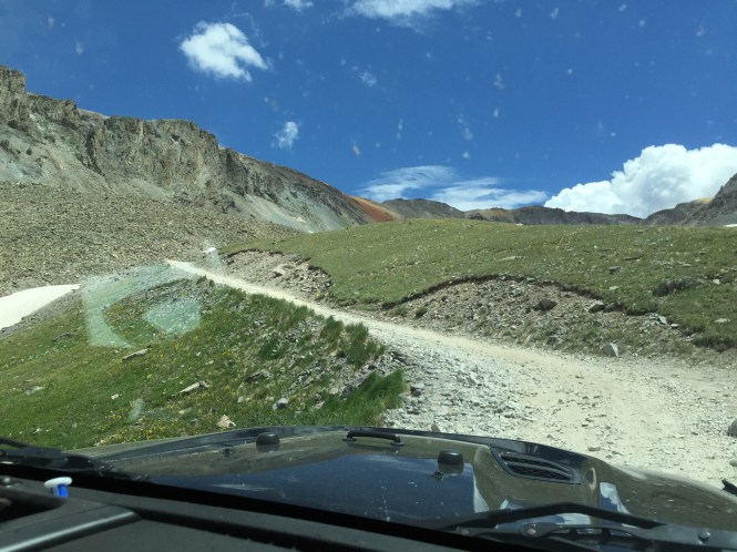
Starting up the trail.
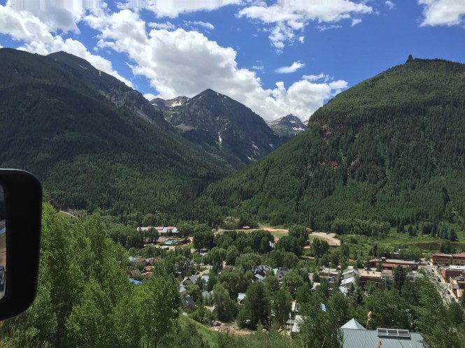
Looking over Telluride, This part of the trail continues to climb in elevation up a series of switchbacks, the scenery just keeps getting better.

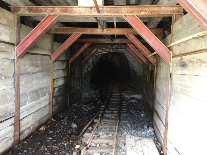
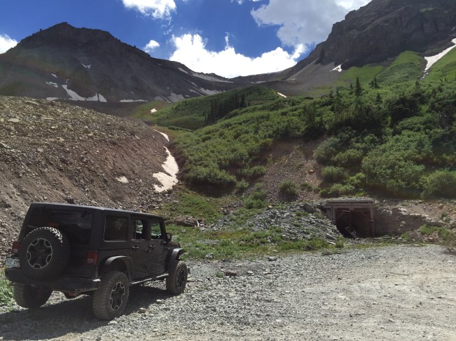
After a little while you come up to this little tunnel, it is a great spot for pictures!
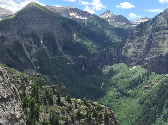
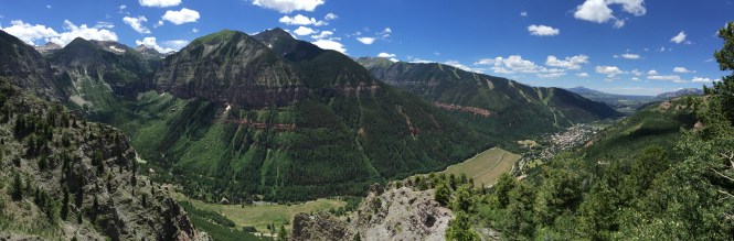
The View point to the right is amazing, you get a really nice view of the old Power house and waterfall, and Black Bear pass.
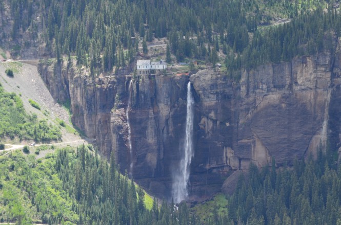
A washed out zoom photo of the power house and waterfall, if you are into history, just Google the Telluride powerhouse, it is very interesting.
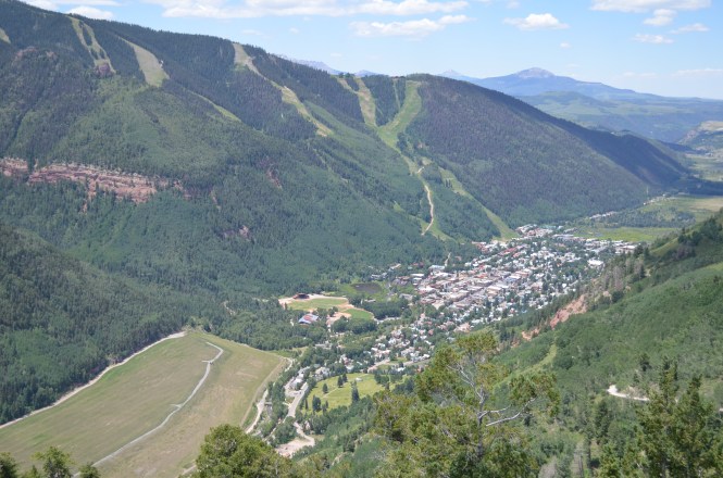
The town of Telluride down below, from the tunnel overlook.


Up next we head towards the old Tomboy mine, passing some shelf roads, and old mining structures.
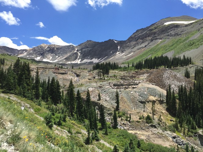
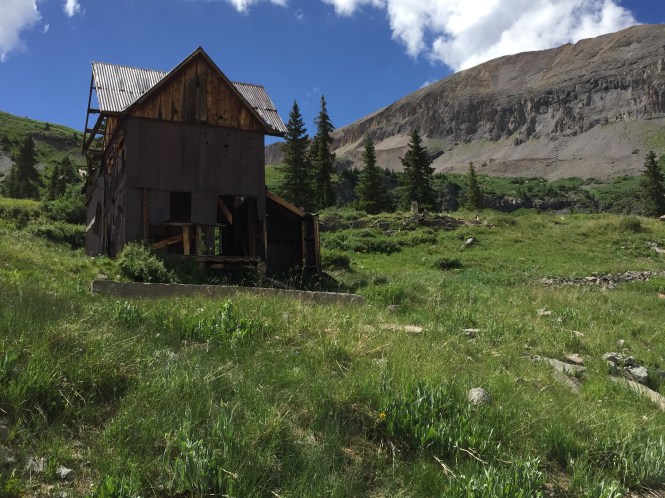
Approaching Tomboy, you can see the ruins left behind, these are all foundations of which were very large structures at one point. If you like history, Google Tomboy Mine, or read the Tomboy Bride, very interesting stuff.


Driving through the ruins, of which was a very large town and mine at one point.


There are multiple paths through this old mine, and even some spur roads, the main road is pretty clear. There are some small shelf climbs as you gain elevation in this area as well.
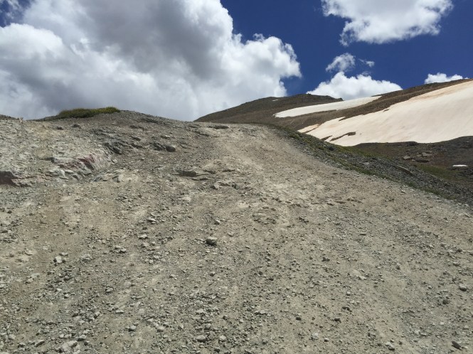
After getting through the mine, you begin climbing the bowl up to the top of the pass.


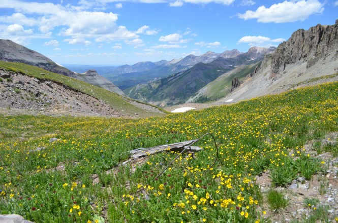
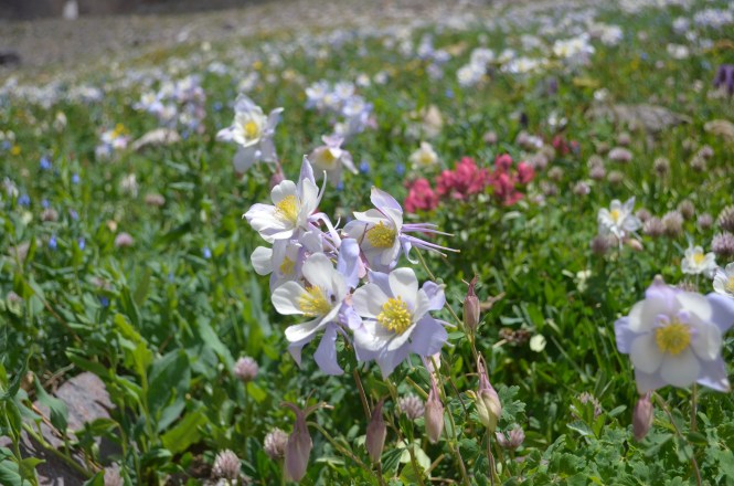
The wild flowers are getting to be amazing in Mid July.
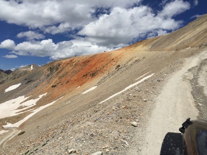
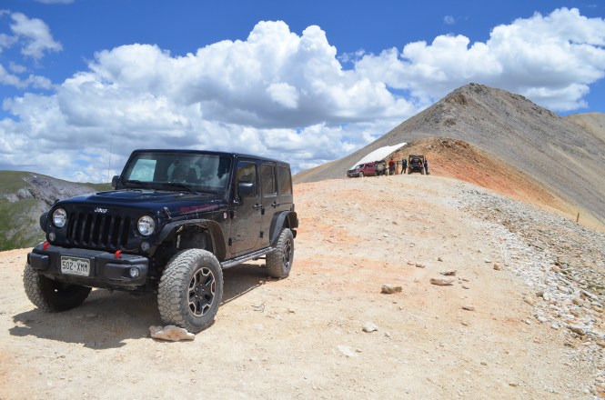
The final climb to the top, includes some steep sharp switchbacks to climb.

Some people were getting in a few more turns in, on what is left of this July snowpack.
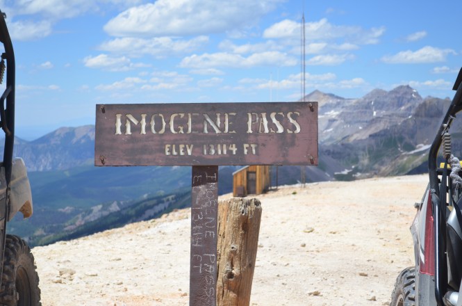

At the top, looking back towards Telluride.
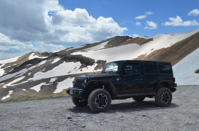
Looking towards Ouray.
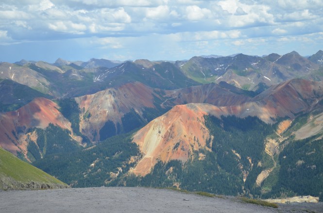
Overlooking red mountain pass, you can see corkscrew pass in the distance.

An old cabin sitting by a high alpine lake.


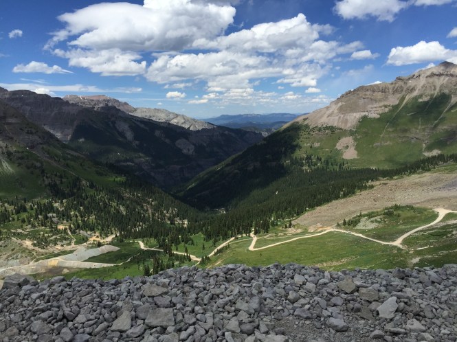
Heading down to Ouray, this side of the pass looks different, it has some steeper ledges as well that you have to watch out for descending down the pass. This picture above is a steep hill with different options and ledges.
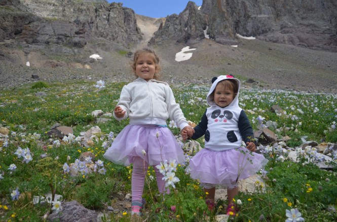

We found a great spot full of wild flowers just off the trail, my kids loved it!
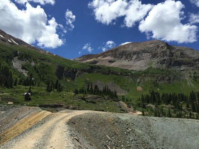
This is a tailing pile you drive over to get to the mine.
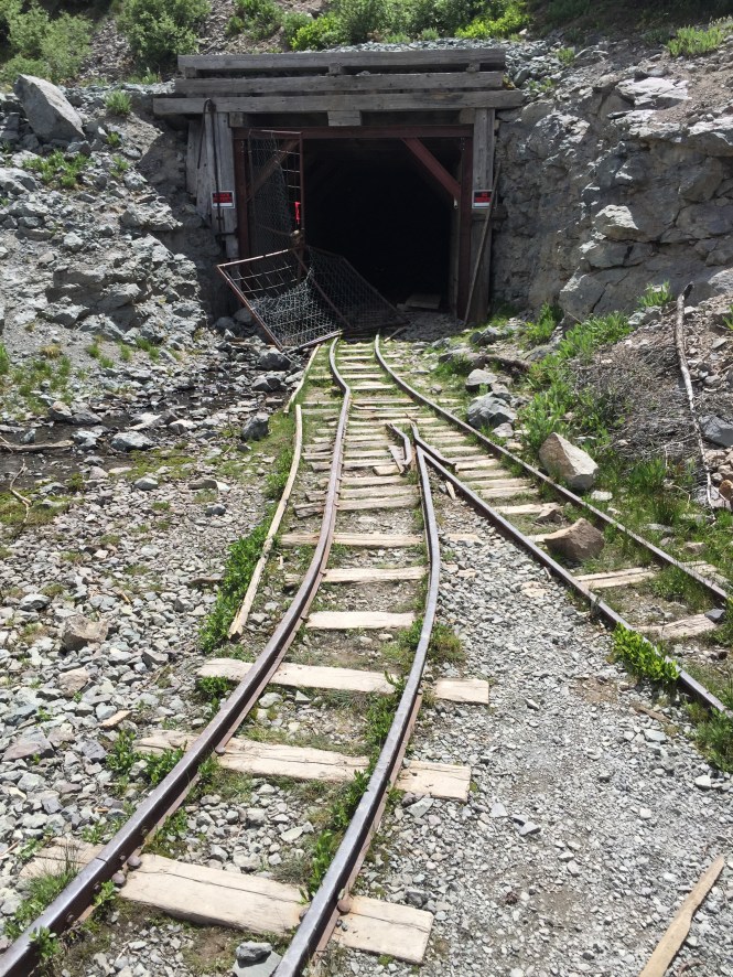

As we made our descent, we stopped at this old mine, it is really neat, there is a mine shaft that is usually locked shut, but someone has broke the gate open, so you can sneak a peek inside it, this is private property.

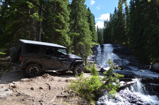
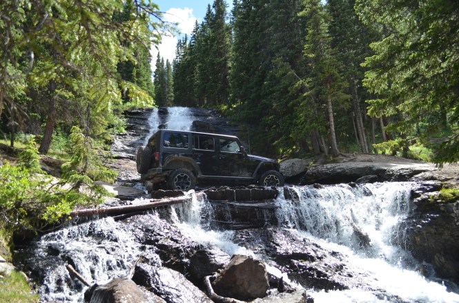


Next we continued on down the line, I stopped next at this really cool waterfall. There are some abandoned mining relics laying around, but the waterfall is great. Most people do not realize there is a small jeep obstacle here. There is a road that leads halfway up the waterfall, the road goes right through it and continues on back down to the start again. This is kind of tricky, to get there it is off camber leading into the water, and the ledge you have to go over is the width of a JK, meaning if you slip off the ledge, you could end up tumbling down the waterfall. My Jeep did fine, I did scrap the bottom a little on the way out.
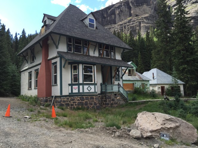
After the waterfall, we made our way to camp bird mine. These are some really well preserved buildings, and neat to look at, they are also private property as well. From here you can either head back to Ouray on a gravel road, or head up to Yankee Boy basin, which is some pretty amazing scenery as well.

Great pass just got to drive it July 6th views are awesome
LikeLike
Thanks, I never get tired of that area!
LikeLike
Thanks for sharing. We were in the area from Florida in June and Black Bear and Imogene were still closed. While I was disappointed we could not do them we did do the Alpine loop which for this guy from flat ass Florida was really exciting. The wife and I will be back next year to finish up our adventure.
Ed and Jill Lapadura
Jeep On!
LikeLike
Sorry to hear you missed out on getting to run Imogene and Black Bear, it was a late snow year, this is the first time I got a chance to run either one, and I live 40 minutes away. The Alpine loop is a great option for getting in the high country!
LikeLike
We were just there July 6 and did the run the other way round 🙂 we didn’t go the mine this time due to cranky teenager but should have maybe she would have gotten out of the Jeep since it was open! LOL Really enjoyed your pictures! Keep on Jeeping 🙂
LikeLike
Thanks, this is one of truly unique trails in Colorado!
LikeLike
Reblogged this on Smokey the Jeep and commented:
Beautiful scenery. Thanks for sharing this. I absolutely cannot wait to wheel the Ouray area! (Counting on summer 2017!)
LikeLike
Thanks, I am going to keep chipping away at even more trails in the area throughout the rest of summer.
LikeLiked by 1 person